Article by Peter Rosengren (CNet)
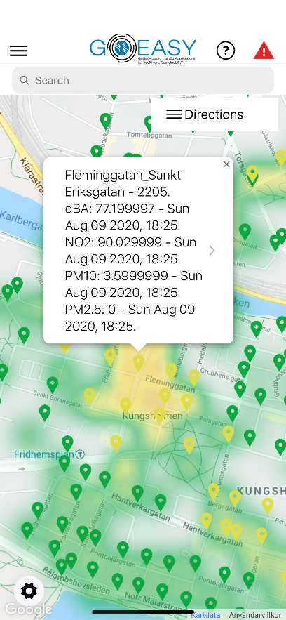
The AsthmaWatch application combines Galileo satellite positioning data with live air quality monitoring data to offer people with asthma and other lung related diseases a fine grained air quality map over their city. This map is the basis of several services included in the AsthmaWatch app, such as early warnings of areas with low air quality, best route selection from a pollution point of view, current and historical pollution rendering at specific points of interest in the city – aiming at improving the quality of life for people with asthma and other lung related diseases.
We have now extended the GOEASY data collection platform to also include data from the Copernicus Atmosphere Monitoring Service (CAMS). CAMS is one of the six services that form Copernicus, the European Union’s Earth observation programme which looks at our planet and its environment for the benefit of all European citizens. The Copernicus system is based on a set of satellites and ground-based observation stations.
Data from CAMS is defined as Gridded Binary (GRIB) files, a standard used in meteorology for historical and forecasted weather data. It is possible to retrieve weather data up to three days in the future. The main difference from the other sources is that data is not retrieved for a specific location. Instead, an area (grid) together with pollutant type and time for when the forecast should be valid. This results in a GRIB file where values together with locations within the defined grid are defined in a checkerboard-like pattern for the specific time.
The problem with the GRIB format is that it is complex to understand and requires specific software to parse and therefore so far is being used in specialized weather forecast software, while today’s Internet of Things (IoT) programmers want easy to use JSON-based formats like OGC (Open Geospatial Consortium). In GOEASY we have developed an advanced translation software that translates GRIB data into OGC so that it can be easily integrated and used in any IoT application.
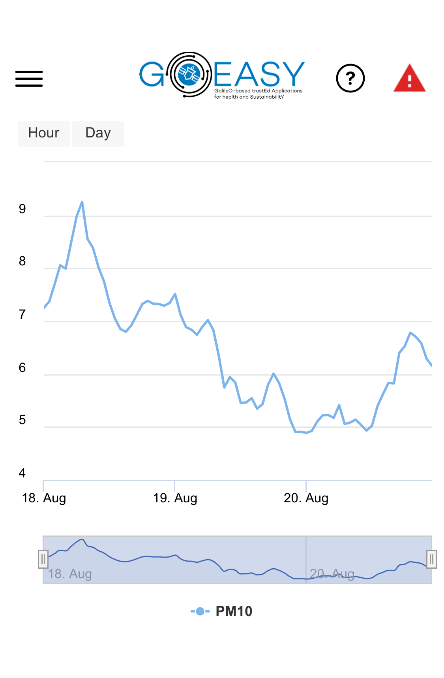
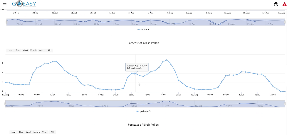
In the AsthmaWatch smartphone app we already show the current level of different pollutants and visualize the historical readings at a certain point-of-interest. Now this has been extended to also present the user with an instant forecast for the coming three days including 8 different pollens, 5 pollutants, solar radiation and temperature.